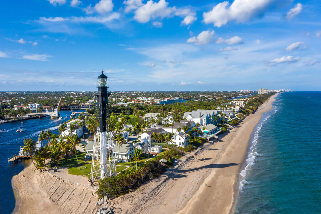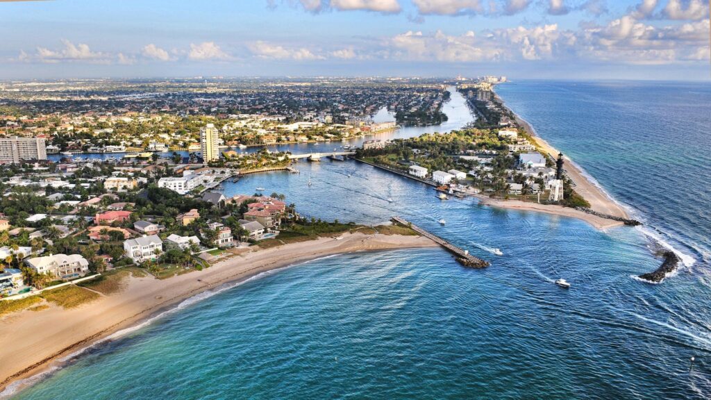

Hillsboro Inlet is the natural inlet between Hillsboro Beach and Pompano Beach in northern Broward County, and the closest route to the ocean for boats kept in Lighthouse Point. It is short and well marked, but it shoals often, runs strong currents, and gets rough in east winds, so experienced captains time every run.
Hillsboro Inlet at a glance
| Fact | Hillsboro Inlet |
|---|---|
| Location | Between Hillsboro Beach (north) and Pompano Beach (south), just east of Lighthouse Point |
| Bridge | State Road A1A drawbridge; opens on signal, but only every 15 minutes from 7 a.m. to 6 p.m. |
| Bridge radio | Bridge tender monitors VHF channel 16 and works channel 13 |
| Landmark | Hillsboro Inlet Light, lit in 1907, light 136 feet above the water |
| Maintained by | Hillsboro Inlet District, a special taxing district created in 1957 |
| Chart | NOAA chart 11467 |
| Nearest other inlets | Boca Raton Inlet about 5 miles north; Port Everglades about 10 nautical miles south |
| Bimini, Bahamas | Roughly 53 nautical miles in a straight line |
Where Is Hillsboro Inlet?
The inlet cuts through the barrier island in northeast Broward County. Hillsboro Beach and its lighthouse sit on the north side, and Pompano Beach sits on the south side. Inside, the inlet meets the Intracoastal Waterway directly across from Lighthouse Point, which is why so many Lighthouse Point canal homes are a short run from the ocean.
The next inlets are Boca Raton Inlet, about 5 miles north, and Port Everglades, about 10 nautical miles south in Fort Lauderdale. Port Everglades is a deep commercial harbor, while Hillsboro is a smaller, shallower natural inlet used mostly by recreational boats and fishing charters.
How Do You Run Hillsboro Inlet Safely?
Run the inlet in good light, on a rising tide when you can, and only after checking the wind and sea. NOAA’s U.S. Coast Pilot warns that, except in a flat calm, the mouth of the inlet has breaking and confused seas, and that conditions get worse as wind and seas build, especially on an outgoing tide.
It reports tidal currents through the narrow channel of up to 7 knots and strong easterly winds from November through May, the same months many owners use their boats most.
The Coast Pilot also reports shoaling just outside and inside the inlet, with low-tide depths as shallow as 1 to 3 feet in places, and a sandbar on the north side inside the inlet.
Those conditions change after every storm, so use NOAA chart 11467 as a starting point, watch how the charter boats are running, and call the Fort Lauderdale Coast Guard Station at 954-927-1611 for current local conditions if you are unsure.
For a new owner, the practical rule is simple: learn the inlet with someone who runs it often before you take it alone, and plan bigger trips around the tide.
How Does the Hillsboro Inlet Bridge Work?
The State Road A1A drawbridge crosses the inlet itself, so every boat that cannot fit underneath waits for an opening. Under federal rules, the bridge opens on signal, but from 7 a.m. to 6 p.m. it only has to open on the hour, quarter hour, half hour, and three-quarter hour. Government vessels and tugs with tows can pass at any time.
The bridge tender monitors VHF channel 16 and works on channel 13. NOAA’s Coast Pilot gives two figures for the closed clearance, 23 feet at the center of the span in one passage and 13 feet in another, so read the clearance boards at the bridge rather than relying on either number.
An overhead power cable at the bridge has a clearance of 64 feet, which matters for tall sailboats and some sportfish towers. The Coast Pilot also reports flood currents of 5 to 6 knots past the bridge, so hold well back while you wait.
Why Does Hillsboro Inlet Keep Filling With Sand?
Sand moves along this coast constantly, and a natural inlet traps it. The inlet’s jetty was first built in 1930, when the channel was deepened to 175 feet wide and 10 feet deep, and the inlet has needed regular dredging ever since. Storms speed the process up.
2026 was a hard year. After nor’easters in March and April, local charter captains told the inlet district’s board that the ocean-side channel was passable only at certain tides, with one reporting about 3.5 feet under his boat shortly after high tide.
The district dredged 83,500 cubic yards of sand in the first four months of 2026, compared with 150,525 cubic yards in all of 2025. Its dredge supervisor said 14 feet is the preferred depth for large boats, with 10 feet as the interim target while weather allowed work to continue.
The lesson for buyers is that the inlet is actively maintained, but its depth is not fixed. If you plan to keep a deep-draft boat in Lighthouse Point, ask about recent inlet conditions and talk to local captains, not only the listing agent.
Who Maintains Hillsboro Inlet?
A local special district maintains the inlet. The Hillsboro Inlet District is a special taxing district the Florida Legislature created in 1957 to keep the inlet open for navigation and drainage.
The district operates its own dredge and moves sand that builds up on the south side of the inlet to the public beaches to the south, helping keep those beaches wide.
As a taxing district, it is funded by property owners within its boundaries in northeast Broward County. Local support runs deep: when a 1994 referendum asked whether to abolish the district, more than 89 percent of voters chose to keep it. Its public board meetings are where boaters and charter captains raise inlet problems.
What Is Near Hillsboro Inlet?
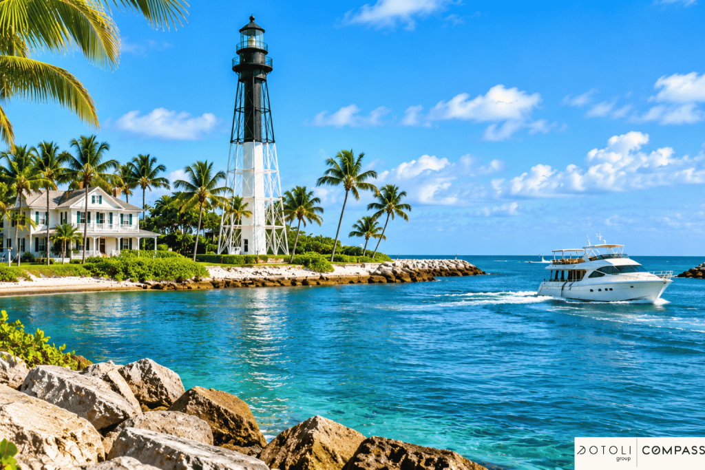
On the north side of the inlet, the Hillsboro Inlet Light stands on Coast Guard grounds in Hillsboro Beach. It was first lit in 1907; its light sits 136 feet above the water, and Lighthouse Point is named after it. The grounds are not open daily, but the Hillsboro Lighthouse Preservation Society runs public tours on set dates.
The inlet is also a long-standing base for party fishing boats and charters, according to the Coast Pilot, because deep water is close. Along this stretch of coast, the 20-fathom (120-foot) depth curve lies less than 2 miles offshore, and fish havens sit 1 to 2.4 miles offshore between this inlet and Port Everglades. For a Lighthouse Point owner, that short run to deep water is a big part of the appeal.
How Does Hillsboro Inlet Compare With Port Everglades and Boca Raton Inlet?
Each nearby inlet suits a different kind of boater. Hillsboro is the most convenient for Lighthouse Point and Pompano Beach, Port Everglades is the safest for large yachts, and Boca Raton Inlet is the smallest of the three.
Northern Broward and southern Palm Beach inlets compared
| Inlet | Best for | Watch out for |
|---|---|---|
| Hillsboro Inlet | Lighthouse Point and Pompano Beach owners; offshore fishing; quick ocean access | Shoaling, strong currents, breaking seas on the ebb, the A1A drawbridge schedule |
| Port Everglades | Large yachts and deeper drafts; most predictable conditions | Commercial and cruise ship traffic; a long run south for Lighthouse Point boats |
| Boca Raton Inlet | Small boats with local knowledge | The Coast Pilot calls it dangerous for boats not designed for open seas; the channel is unmarked and shifts |
What Should Lighthouse Point Buyers Check About Inlet Access?
Inlet access is only as good as the route from your dock. Before you make an offer on a Lighthouse Point waterfront home, trace the route from the dock to the Intracoastal Waterway and then to the inlet, and check four things.
- Bridges on the route. Note any fixed street bridge between the dock and the Intracoastal and its clearance, plus the A1A drawbridge at the inlet. Our guide to bridge clearance for boats explains how to measure what will fit.
- Water depth. Check the canal depth at low tide in front of the dock and along the route, not just the depth the listing quotes.
- The dock and seawall. Confirm dock and lift permits, usable dock length, and the seawall’s condition with an inspection. See our seawall inspection guide and dock permit guide.
- Your boat today and in five years. Many buyers move up in size. Our guide to what size boat you can keep at a canal home shows how to check the fit.
For the bigger picture on the city itself, including prices, flood zones, and schools, read our guide Is Lighthouse Point, Florida a good place to live?, or browse current Lighthouse Point waterfront homes for sale.
Frequently Asked Questions
Is Hillsboro Inlet dangerous?
It can be. NOAA’s Coast Pilot reports currents of up to 7 knots, shifting shoals and breaking seas at the mouth except in a flat calm, worst on an outgoing tide and in strong east winds. Experienced captains run it safely every day by timing the tide and checking conditions first.
Does the Hillsboro Inlet bridge open on demand?
Partly. The A1A drawbridge opens on signal, but from 7 a.m. to 6 p.m. it only has to open on the hour, quarter hour, half hour, and three-quarter hour. Call the bridge tender on VHF channel 16, then work on channel 13.
How deep is Hillsboro Inlet?
Depth changes with the sand. The district aims for about 14 feet for large boats but used 10 feet as an interim target after the 2026 storms, and the Coast Pilot reports spots of only 1 to 3 feet at low tide. Check recent conditions before each trip.
Who maintains Hillsboro Inlet?
A special taxing district created in 1957, the Hillsboro Inlet District, maintains the inlet. It runs its own dredge and moves sand from the inlet to the beaches south of it.
How far is Bimini from Hillsboro Inlet?
Bimini is roughly 53 nautical miles from the inlet in a straight line, and West End on Grand Bahama is about 65. The actual route depends on the Gulf Stream and the weather window.
Can you visit the Hillsboro Inlet Lighthouse?
Yes, on set tour dates. The lighthouse sits on Coast Guard grounds in Hillsboro Beach, so it is not open daily, and the Hillsboro Lighthouse Preservation Society organizes public tours.
Looking for a Home With Fast Inlet Access?
The difference between a good and a great boating home in Lighthouse Point is often the route to the inlet: the bridges, the depth, and the dock.
The DOTOLI Group is a Compass real estate team led by Josh Dotoli, with an office at 1200 E Las Olas Blvd in Fort Lauderdale, and we check the water route along with the house before our clients make an offer. Contact our team to see Lighthouse Point homes that fit your boat.